Drone Photography Services produce amazing quality aerial photography and aerial filming using the latest GPS enabled multi-rotor drone quadcopters.
Drone Photography Services has Civil Aviation Authority (CAA) “Permission for Aerial Work” PFAW which means we are a licensed commercial operator of UAV’s (unmanned aerial vehicles) drones in the U.K.
All of our skilled pilots have passed the CAA-approved exams, flight assessments, and hold the established industry Remote Pilot Qualification (RPQ-s) for multi-rotor aircraft under 7kg.
Our experienced pilots are capable of flying our agile drones close to difficult locations, while maintaining the highest standards in safety and operation.
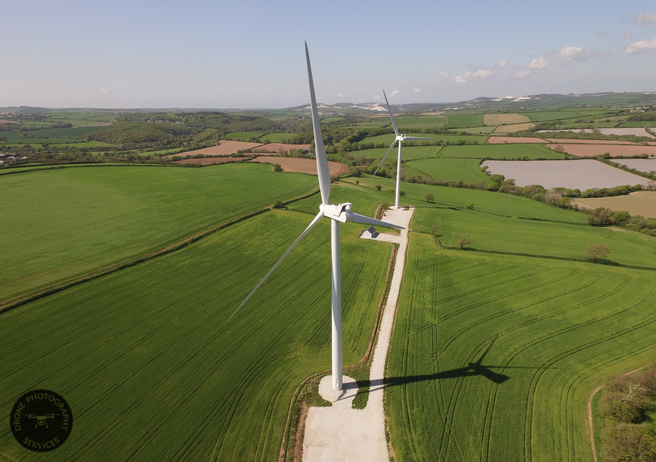
Drone Photography Services are pioneering commercial drone photography flying up to 400ft, turning new ideas for aerial imagery into stunning reality.
Our unmanned aerial vehicles (UAV’s) carry cameras using the best gyro-stabilised gimbals to produce ultra sharp HD 4K video and 12 megapixel still images.
We are now producing cost-effective aerial drone videography with shooting angles and reveals, previously only available on big budget productions.
Our Services
Corporate Videos
Video content is a key component of any business digital marketing strategy. A short one – two minute video gives the viewer an understanding of your business and an awareness of your products and services.
Building Inspection and Surveys
Drone Photography Services are specialists in high-level aerial building, tower, chimney, roof surveys and inspections using radio controlled quadcopter drones UAV ’s.
Construction Sites
Construction site aerial photography can show every stage of a development from planning, foundations, building topping out through to completion. There is no better way of getting an overview of a construction site that by using aerial photography.
Estate Agents
We produce dramatic aerial property photography and videos for residential estate agents. Aerial videos and photographs capture the scale of the property, land, gardens and surrounding, not possible with ground-based photography.
Commercial Property
As commercial agents if you are selling or leasing commercial property, there is now a cost effective way to produce stunning aerial photographs and videos of offices, retail parks, industrial units, factories, farms and land.
Agriculture
With our drones (UAV’s) it is now easy to view any given land area and turn it into actual data in a few hours. Precision agriculture is now affordable using drone (UAV) technology.
Mapping
Drone Photography Services fly our drones (UAV’s) with a high-resolution camera to collect 12 megapixel aerial photographs for a wide variety of commercial mapping uses. We can measure and map hard to reach areas like, quarries, landfill sites and open cast mines.
2D Mapping
We specialise in 2D mapping. Our drone UAV pilots are industry experienced in land surveying and construction.
3D Mapping
To maximise the detail of our 3D mapping we also take aerial images from different point of interests flying around objects at different altitudes in addition to flying the normal overlapping regular grid pattern. As all the images are geo-referenced, these additional images add depth and detail to the final 3D rendered model.
Sport, Travel ad Tourism
Drone Aerial Photography and videography using unmanned aerial vehicles (UAV’s) can now really show the sports, leisure, travel and tourism industries from an exciting and affordable viewpoint, previously only available from expensive helicopter or manned aircraft shoots.
Weddings
Drone Photographic Services work with ground based wedding photographers to cover your wedding from a stunning aerial view high above the church and venue. So let us take extraordinary aerial photos and video of the most memorable of days.
Drone Photography Services has Civil Aviation Authority (CAA) “Permission for Aerial Work” PFAW which means we are a licensed commercial operator of UAV’s (unmanned aerial vehicles) drones in the U.K.
All of our skilled pilots have passed the CAA-approved exams, flight assessments, and hold the established industry Remote Pilot Qualification (RPQ-s) for multi-rotor aircraft under 7kg.
Our experienced pilots are capable of flying our agile drones close to difficult locations, while maintaining the highest standards in safety and operation.
Drone Photography Services are pioneering commercial drone photography flying up to 400ft, turning new ideas for aerial imagery into stunning reality.
Our unmanned aerial vehicles (UAV’s) carry cameras using the best gyro-stabilised gimbals to produce ultra sharp HD 4K video and 12 megapixel still images.
We are now producing cost-effective aerial drone videography with shooting angles and reveals, previously only available on big budget productions.
Our Services
Corporate Videos
Video content is a key component of any business digital marketing strategy. A short one – two minute video gives the viewer an understanding of your business and an awareness of your products and services.
Building Inspection and Surveys
Drone Photography Services are specialists in high-level aerial building, tower, chimney, roof surveys and inspections using radio controlled quadcopter drones UAV ’s.
Construction Sites
Construction site aerial photography can show every stage of a development from planning, foundations, building topping out through to completion. There is no better way of getting an overview of a construction site that by using aerial photography.
Estate Agents
We produce dramatic aerial property photography and videos for residential estate agents. Aerial videos and photographs capture the scale of the property, land, gardens and surrounding, not possible with ground-based photography.
Commercial Property
As commercial agents if you are selling or leasing commercial property, there is now a cost effective way to produce stunning aerial photographs and videos of offices, retail parks, industrial units, factories, farms and land.
Agriculture
With our drones (UAV’s) it is now easy to view any given land area and turn it into actual data in a few hours. Precision agriculture is now affordable using drone (UAV) technology.
Mapping
Drone Photography Services fly our drones (UAV’s) with a high-resolution camera to collect 12 megapixel aerial photographs for a wide variety of commercial mapping uses. We can measure and map hard to reach areas like, quarries, landfill sites and open cast mines.
2D Mapping
We specialise in 2D mapping. Our drone UAV pilots are industry experienced in land surveying and construction.
3D Mapping
To maximise the detail of our 3D mapping we also take aerial images from different point of interests flying around objects at different altitudes in addition to flying the normal overlapping regular grid pattern. As all the images are geo-referenced, these additional images add depth and detail to the final 3D rendered model.
Sport, Travel ad Tourism
Drone Aerial Photography and videography using unmanned aerial vehicles (UAV’s) can now really show the sports, leisure, travel and tourism industries from an exciting and affordable viewpoint, previously only available from expensive helicopter or manned aircraft shoots.
Weddings
Drone Photographic Services work with ground based wedding photographers to cover your wedding from a stunning aerial view high above the church and venue. So let us take extraordinary aerial photos and video of the most memorable of days.
